

Summer Convective Weather: Cumulonimbus Clouds, Hail, and the Microburst Threat
A cloud that can climb higher than Mount Everest. Ice that can shatter a windscreen miles away from the thunderstorm that created it. A weather radar painted in red and magenta. An invisible column of descending air, capable of overpowering even the most capable aircraft.
Thunderstorms remain among the most dangerous weather phenomena in aviation. Every summer, flight crews around the world are reminded that convective weather demands knowledge, sound judgment, and, above all, respect.
In this episode, we’re shifting our focus from ground operations to the sky, exploring one of the most dynamic and unforgiving environments a flight crew can encounter: convective weather. We’ll cover three hazards every pilot should be able to describe confidently in Aviation English: cumulonimbus clouds, hail, and microbursts.
Hello, I’m Emilia Barska, and welcome to Revise Before Flight, your regular check on essential Aviation English. As a General English teacher and Aviation English specialist, my goal is to help you climb and maintain ICAO Level 5 Extended or Level 6 Expert.
Hello, aviators, and welcome back to Episode 18. Today’s topic: the summer convective weather season, cumulonimbus clouds, hail, and the microburst threat.
Before we begin, a quick note: we study severe weather not to create fear, but to build respect. Aviation today benefits from advanced weather radar, predictive wind shear warning systems, sophisticated forecasting, and rigorous pilot training. Yet one timeless principle remains unchanged.
My focus today is on Aviation English and the operational language pilots use to describe, communicate, and avoid convective weather. Because in aviation, describing the weather correctly is more than good English, it supports good decision-making. Understanding the weather is only half of the job. Being able to describe it precisely is what keeps aviation communication clear and professional.
Cumulonimbus Clouds
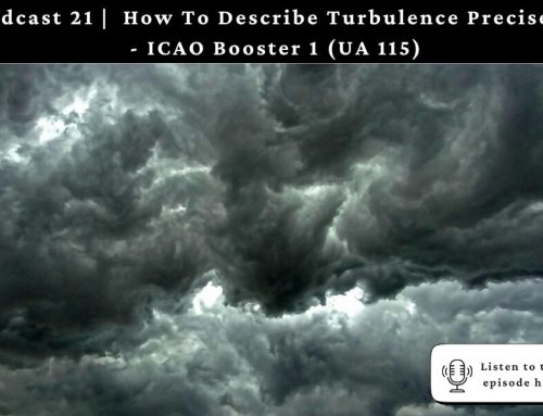
During the warmer months of the year, rising temperatures create atmospheric instability. When warm, moist air begins to rise rapidly, it can develop into towering cumulonimbus clouds, commonly known as CBs. A mature cumulonimbus may extend from just above the ground to more than 50,000 feet, making it one of the tallest cloud types on Earth.
These clouds are powerful convective systems, capable of producing severe turbulence, heavy precipitation, icing, lightning, hail, wind shear, and microbursts. For flight crews, a thunderstorm is never just bad weather. It is a complex environment where multiple hazards often exist simultaneously.
For that reason, pilots are trained to avoid active convective cells whenever possible, rather than attempting to penetrate them. As many instructors say, the safest place near a thunderstorm is well away from it.
So how should we describe a CB during an ICAO English assessment? At Level 4, you might simply say, “a cumulonimbus cloud is a towering convective cloud capable of producing thunderstorms.” For Level 5 and Level 6, examiners expect more than basic operational vocabulary. Instead of saying “there was a storm,” use expressions such as convective activity, developing cumulonimbus, embedded CBs, active thunderstorm cell, line of thunderstorms, areas of intense convection, or isolated/scattered CBs.
For example: “The planned route was affected by scattered cumulonimbus clouds associated with moderate convective activity.” Notice that this sounds far more operational and closely reflects real aviation communication.
Hail: The Hazard You May Not See
Inside every mature cumulonimbus cloud, powerful updrafts lift water droplets high above the freezing level. The droplets freeze, fall, are lifted again, and gradually build multiple layers of ice. Eventually, they become too heavy for the updraft to support and fall as hail.
Many people assume hail exists only inside the visible storm core. In reality, strong upper-level winds can carry hail several miles beyond the cloud itself. This means an aircraft may encounter hail while flying beneath the anvil, or even in what appears to be relatively clear air.
For an aircraft, hail can crack windscreens, dent the fuselage, damage leading edges, destroy the radome, and seriously damage engine fan blades.
When discussing hail during an ICAO exam, useful operational phrases include: request a weather deviation, avoid convective activity, circumnavigate a thunderstorm, maintain separation from thunderstorm cells, encounter moderate to severe turbulence, receive a wind shear alert, and execute a go-around.
For example: “The crew requested a 20-mile deviation to avoid the thunderstorm and associated hail.”
Microburst: The Invisible Killer
Perhaps the most dangerous type of thunderstorm hazard for aircraft operating near the ground is the microburst. A microburst is an intense, localized downdraft. Cold, dense air rapidly descends from a thunderstorm, strikes the ground, and spreads outward in every direction. The entire event usually lasts only a few minutes, yet wind speeds may exceed 100 knots.
Aircraft are particularly vulnerable during takeoff and landing, where there is little altitude available for recovery. A typical encounter follows a dangerous sequence: first, the aircraft flies into a headwind and experiences an increase in airspeed. The pilot may reduce engine thrust. Seconds later, the aircraft enters the downdraft and begins losing altitude. Finally, it encounters a strong tailwind, airspeed decreases rapidly, and lift is reduced. At low altitude, there may simply not be enough time or energy to recover.
This combination of rapidly changing wind direction and speed is known as wind shear.
One of the best-known examples occurred in 1985, when a Delta Air Lines Lockheed L-1011 crashed while approaching Dallas/Fort Worth International Airport. During a thunderstorm, the aircraft encountered a powerful microburst on final approach. The accident claimed 137 lives.
Following the tragedy, the aviation industry introduced major improvements, including Doppler weather radar, low-level wind shear alert systems, predictive wind shear systems, and enhanced pilot training focused on microburst recognition and recovery. Many of today’s weather detection systems exist because aviation continues to learn from past accidents.
Thunderstorm Avoidance
One principle remains unchanged: avoid thunderstorms. Don’t try to outfly them. Pilots generally aim to remain at least 20 nautical miles away from severe thunderstorm cells whenever possible. If weather blocks the planned route, crews coordinate with air traffic control to request deviations around areas of convective activity.
Remember, no aircraft is stronger than a mature thunderstorm. Good judgment is demonstrated not by flying through hazardous weather, but by avoiding it altogether. As the old aviation saying goes, “It’s better to be on the ground wishing you were in the air, than in the air wishing you were on the ground.”
Professional Insight
For ICAO Level 5 and 6 candidates, describing weather means much more than naming clouds. Examiners expect you to explain how the weather affected the flight, what operational risks developed, and how the crew managed those risks.
For example: “Due to severe convective activity, the crew discontinued the approach, executed a go-around, and entered a holding pattern until weather conditions improved.”
Thunderstorms teach one of aviation’s most valuable lessons: not every threat is visible. A microburst cannot always be seen, hail may exist well outside the visible storm, and wind shear can develop within seconds. Professional pilots respect thunderstorms not because they fear them, but because they understand the hazards they present.
Recap
Thank you for developing your operational Aviation English with me. Until next time, keep your weather radar active, your deviations timely, your communication precise, and, as always, clear skies, aviators.





Leave A Comment